
Plymouth ZIP Code: Four Listings
The Plymouth ZIP code directory draws first from the official Minnesota Department of Public Safety county and ZIP reference, which identifies four ZIP codes for Plymouth in Hennepin County: 55441, 55442, 55446, and 55447. This is the complete list found in that state source. It is not a neighborhood map, a roster, or a street-boundary index. The same source does not identify a station for each code, mark any as PO-box-only, describe a split or realignment, or assign the codes to named Plymouth neighborhoods. Verify each target address through USPS before drawing a postal conclusion.
| ZIP code | Official state listing | Post-office detail | Research note |
|---|---|---|---|
| 55441 | Plymouth, Hennepin County | Not identified in the inspected official source | Use USPS for a specific address. |
| 55442 | Plymouth, Hennepin County | Not identified in the inspected official source | Do not treat the ZIP as a city boundary. |
| 55446 | Plymouth, Hennepin County | Not identified in the inspected official source | Plymouth Library is a local landmark in this ZIP, not its full boundary. |
| 55447 | Plymouth, Hennepin County | Not identified in the inspected official source | No neighborhood or delivery-area claim was located. |
The state list gives a useful starting point: it confirms which codes the state table associates with Plymouth, while address-level delivery and municipal questions still require separate official checks.
Validate a Plymouth ZIP Code With USPS
USPS ZIP Code Lookup is the address-level postal tool for this question. Its By Address route requires street address, city, and state, with ZIP optional. By City and State requires those two fields, while Cities by ZIP starts with a ZIP. USPS returns delivery naming. It does not establish incorporated-city residency, parcel ownership, or a current person connection. Enter the complete address as printed, retain the normalized result, and compare it with the relevant record custodian.
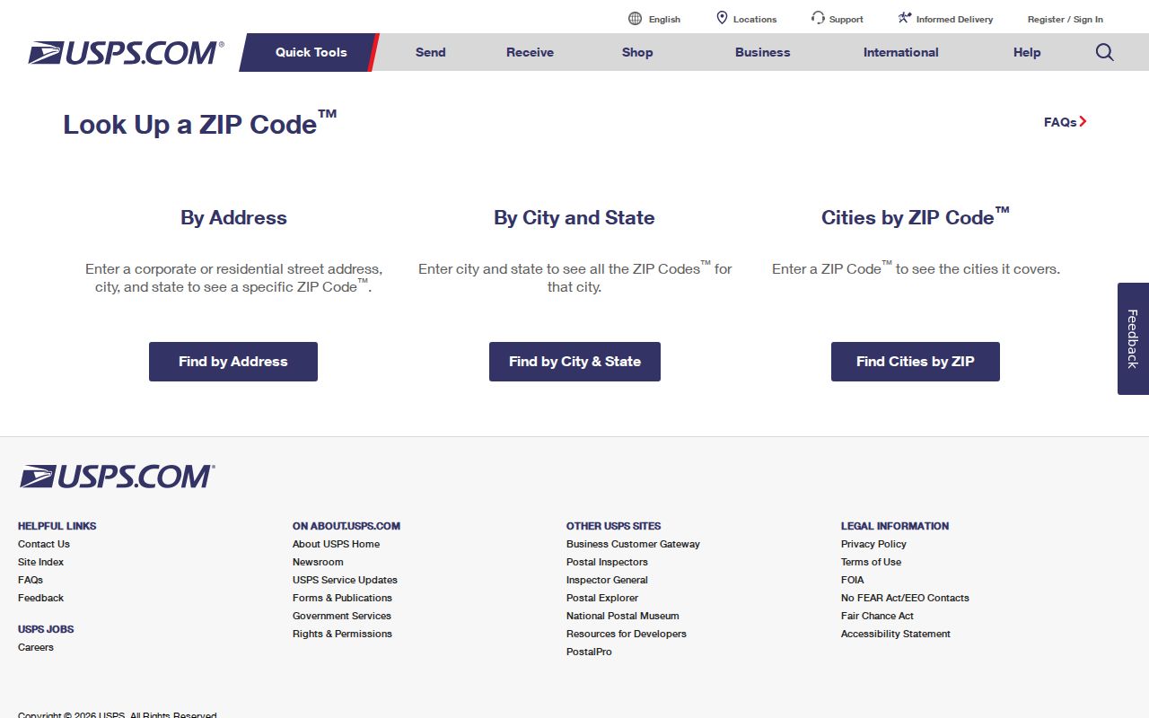
The USPS screen separates address, city-and-state, and ZIP-based tasks. That distinction keeps delivery validation first and prevents a postal match from being treated as a resident search result.
| USPS route | Required entry | Appropriate result |
|---|---|---|
| By Address | Street address, city, and state | Delivery-form check for one address. |
| By City and State | City and state | Postal lookup starting from a place name. |
| Cities by ZIP | ZIP code | Postal city naming associated with the code. |
Plymouth ZIP Codes and City Limits
ZIP codes are delivery geographies, while Plymouth city limits are municipal geography. Those boundaries can differ. An address with a Plymouth postal label can need a city-limit check, and a location within a city boundary can use postal naming that does not answer a municipal record question. The research did not locate an official ZIP-by-neighborhood map or a source that assigns a full street boundary to each of the four codes. Avoid filling that gap with assumptions from a broad ZIP map.
Compare the USPS result with the Plymouth ParcelViewer city-limit and parcel layers, then use Hennepin parcel data for the situs address and PID. Census ZIP Code Tabulation Areas are statistical approximations, not USPS ZIP boundaries. They can offer broad demographic context, but they should not replace a delivery result or city map when researching one Plymouth location.
No Plymouth Parcel Portal Filters by ZIP
The inspected official property tools do not support a ZIP-wide parcel or resident filter. Hennepin PINS accepts a house number and street name, a PID, or an addition name. Its address tab has an optional unit field, but no ZIP field was exposed. The Hennepin Property Map has interactive parcel context, and Plymouth ParcelViewer has map-service controls, but neither inspection located a ZIP search that produces a Plymouth resident list. This gap is important: do not claim that an official portal can filter Plymouth people or parcels by ZIP when the research did not find one.
Use the ZIP as an address-verification step, then search the known address in PINS. The county portal can return parcel, assessment, tax, sales, legal-description, and recent-recording context. A mailing field or taxpayer display remains a property record field, not proof that everyone connected with the parcel is a present resident.
Plymouth ZIP Code Use in MNVotes
Minnesota's Voter Registration Lookup includes a ZIP Code search mode, but it is not a public Plymouth resident list. The lookup requires first name, last name, date of birth, ZIP or county/city choice, house number, street, and an optional unit. In county mode, the user selects Hennepin and Plymouth. The system returns registration confirmation or mismatch guidance for the person and address entered, subject to its rules and data classification.
A blank result does not prove nonresidence. It can reflect name format, an address mismatch, pending processing, an inactive registration, a changed address, a ZIP or city mismatch, or a protected record. The portal updates nightly, while a new application may take up to 14 days and then appear after processing. Minnesota Statutes section 201.091 controls voter-list access, so a ZIP field in a registration form should not be turned into a general public people list.
Find a Plymouth Address Within One ZIP
A precise workflow narrows an address without claiming a ZIP-wide person search. It starts with delivery validation, moves to municipal and parcel geography, then goes to the record that fits the property or historical question. Each step creates a checkable note instead of a broad list of names.
- Use USPS with the full street address, city, and state. Preserve the original address and the returned delivery form.
- Open Plymouth ParcelViewer to check city limits, roads, building footprints, parcels, lakes, and zoning around that location.
- Run the verified house number and street in Hennepin PINS, then save the PID and legal-description details needed for county records.
- Use the Recorder, city permit route, or historical collection only for the defined question. Their access rules and coverage are different.
- For a full street-level property trail after the ZIP step, use the Plymouth Street Directory route rather than trying to stretch the ZIP into a parcel list.
Note: A good ZIP research note records the original address, USPS result, parcel result, city-limit check, search date, and any unresolved postal or historical alias.
Historical Plymouth ZIP and Address Names
Older sources may use a former city name, route, road number, or suffix. Preserve that text before normalizing it. The confirmed local example is County Road 47, renamed Chankahda Trail in 2022. That road-name change can affect postal, parcel, directory, permit, newspaper, and planning searches. A historical address may also fall under the New Hope-Plymouth-Wayzata directory grouping, which is a collection label rather than proof that the cities shared a municipal government.
For family, school, neighborhood, and address history, Hennepin Library Special Collections, the digitized 1964-1983 suburban directories, and the Plymouth History Center give dated context that a ZIP alone cannot provide. Keep the directory year and page alongside the address, then verify the place with map and parcel information. This approach respects the difference between an archival listing and a current connection.
Plymouth ZIP Code Terms to Keep Separate
These postal terms describe delivery organization. They are useful for reading a result, but none of them supplies a complete picture of a Plymouth address or the people tied to it.
- ZIP Code
- A five-digit USPS delivery geography. It is not the same thing as an incorporated-city boundary or a parcel boundary.
- ZIP+4
- An added four-digit delivery refinement used with a ZIP Code. It increases routing precision without changing municipal jurisdiction.
- PO-box ZIP
- A ZIP assigned for post-office boxes. The state source did not identify any Plymouth code as PO-box-only, so do not label one that way without USPS confirmation.
- Unique ZIP
- A code assigned to a single organization or high-volume recipient. No such Plymouth designation was established by the inspected official source.
- Carrier route
- A delivery sequence used for mail operations. It does not prove city limits, parcel ownership, or household composition.
Plymouth ZIP Code Checks Need Map Layers
Plymouth's ParcelViewer is especially helpful for geography that a postal listing cannot supply. Its layers include roads, lakes, zoning, building footprints, businesses, parcels, city limits, and the city outline. The service offers Identify, Query, Find, and Export Map operations and supports map-service formats such as JSON and GeoJSON. Use it to orient a verified address and see which public geographic layer applies, not to infer a household relationship from nearby parcels.
County parcel data adds the property identifier, situs address, assessment context, and legal description. The two systems complement USPS: USPS answers delivery naming; the city viewer answers municipal map context; county records answer parcel context. Keeping those roles separate is the most reliable form of ZIP-based Plymouth research.
Limits on Plymouth ZIP Code Research
A Plymouth ZIP code directory does not prove municipal residency, current occupancy, or a right to assemble a person list. Minnesota government data is generally accessible under Minnesota Statutes section 13.03 unless another law classifies it otherwise, but access rules still attach to each custodian and record type. Safe at Home participants use assigned addresses, and their actual locations are protected. Driver and vehicle address data are also restricted.
Use the minimum information needed for an address, property-history, or family-history question. A protected or missing field is a boundary, not a puzzle to solve. Check unusual permit or deed-copy messages through the official city or county contact before sending money or information, because Plymouth warned in 2026 about permit impersonation that used public property context to look convincing.